Two M7 Earthquakes: Kermadec Islands & Kepulauan Batu, Indonesia

  • Thread starter davenn
  • Start date
  • Tags
    Pair
In summary, two M7.1 events occurred in the Kermadec Islands and Indonesia this week. The first event was followed by a couple of M5+ and a couple of M4.9 events. The second event was preceded several days earlier by 3 x M5+ events that could be deemed foreshocks because of their location related to the M7.1.
  • #1
davenn
Science Advisor
Gold Member
2023 Award
9,589
10,256
TL;DR Summary
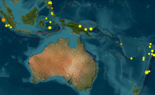
A pair of M7.1 quakes 20 hours and some distance apart ( aka unrelated)
The first one a M7.1 in the Kermadec Isl. region north of New Zealand

M 7.1 - Kermadec Islands, New Zealand​

  • 2023-04-24 00:41:55 (UTC)
  • 29.968°S 177.826°W
  • 43.1 km depth
It was followed by a couple of M5+ and a couple of M4.9 events.
The Fault Plane Solution "beachball" shows a subduction ( thrust) event, typical of this region
where the Pacific Plate is diving under the Australian Plate. with a fault plane angled towards WNW.

1682410558722.png


The second event, roughly 20 hours later was another M7.1 off the west coast of Sumatera, Indonesia.

M 7.1 - Kepulauan Batu, Indonesia​

  • 2023-04-24 20:00:55 (UTC)
  • 0.781°S 98.534°E
  • 15.5 km depth
It was preceded several days earlier by 3 x M5+ events that could be deemed foreshocks because of their location related to the M7.1.
This event occurred near the southern end of the rupture zone of the 26 Dec 2004 M9 event.

The Fault Plane Solution "beachball" shows a subduction ( thrust) event, again, typical of this region
where the Indo-Australian Plate is diving under the Eurasian Plate. with a fault plane angled towards NE.

1682411134546.png
230424  UT M7.1 Kermadecs, 7.1 off wstrn Sumatera zhi.gif
 
  • Wow
  • Like
Likes fresh_42 and Astronuc
Earth sciences news on Phys.org
  • #2

Attachments

  • USGS_Latest Earthquakes(days)_2023-04-25 at 11-23-45.png
    USGS_Latest Earthquakes(days)_2023-04-25 at 11-23-45.png
    118 KB · Views: 71
  • #3
Astronuc said:
I wonder if there will be similar magnitude quakes in the region.

Both regions are quite active, specially the Kermadec area, which will often produce several M7+ events a year and an M8+ event around every 5 - 10 years

I am sure that there would be some that would argue that the Sumatrian event was an aftershock of the 2004 M9 event. It is in the aftershock zone and the area hasnt really returned to the pre-2004 seismicity levels.
 
  • #4
I tried a quick Google search to check on damage and injuries, but it looks like there is nothing significant, right? That would be a good thing. M7 is crazy powerful.

The USGS site links offer a "Did you feel it" section, but it appears to be "Write-Only" where you can enter what you felt, but not read others' responses...
 
  • #5
berkeman said:
I tried a quick Google search to check on damage and injuries, but it looks like there is nothing significant, right? That would be a good thing. M7 is crazy powerful.

Yes, The Kermadec one only has a few islands in the area, main one Raoul Is, an active volcano, frequented by geoscientists and conservation department people

The Sumatra one close enough to 2 large islands Nias and one other and not that far offshore from Sumatra that it would have been widely felt

berkeman said:
The USGS site links offer a "Did you feel it" section, but it appears to be "Write-Only" where you can enter what you felt, but not read others' responses...

sadly yeah :frown:
 

What are the locations of the two M7 earthquakes mentioned?

The two magnitude 7 (M7) earthquakes occurred in the Kermadec Islands region and near Kepulauan Batu, Indonesia. The Kermadec Islands are located in the South Pacific Ocean, northeast of New Zealand, while Kepulauan Batu is situated off the west coast of Sumatra, Indonesia.

What is the significance of these earthquakes being rated M7?

An earthquake with a magnitude of 7 is considered major and can cause serious damage in areas several tens of miles across if it occurs near populated regions. These magnitudes signify a significant release of energy and have the potential to generate tsunamis if they occur under or near the ocean.

Were there any tsunamis reported following the earthquakes?

After significant earthquakes like these, local and international tsunami warning centers assess the potential for a tsunami. Depending on the depth and characteristics of the earthquake, alerts may be issued. For specific events, such as these earthquakes in the Kermadec Islands and Kepulauan Batu, one would need to check updates from official sources like the Pacific Tsunami Warning Center to get accurate information regarding tsunami generation.

What are the potential impacts of earthquakes in these regions?

The potential impacts include structural damage to buildings and infrastructure, especially in poorly constructed structures. There is also the risk of landslides and tsunamis, which can lead to further damage and casualties. The remote nature of the Kermadec Islands may limit human casualties, but the same might not be true for the more populated Indonesian region.

How are local authorities and communities responding to these earthquakes?

Local authorities typically engage emergency response procedures following significant earthquakes, which include assessing the damage, providing aid and support to affected populations, and evaluating the structural integrity of buildings and infrastructure. Community response can involve evacuation if necessary, seeking shelter, and cooperating with emergency services. Continuous monitoring and updates from geological services also play a crucial role in managing the response.

Similar threads

Replies
8
Views
991
Replies
1
Views
903
Replies
31
Views
2K
  • Earth Sciences
Replies
2
Views
3K
  • Earth Sciences
Replies
2
Views
2K
  • Earth Sciences
Replies
5
Views
3K
  • Earth Sciences
Replies
8
Views
5K
Replies
7
Views
7K
  • Sci-Fi Writing and World Building
Replies
6
Views
2K
  • Sci-Fi Writing and World Building
Replies
2
Views
2K
Back
Top