Twan
- 2
- 0
View attachment 8174View attachment 8175
Hi, this is my first post with a problem that I have during my Msc Project.
I will briefly discuss my project and the reason why I would like to solve this problem, if you do not want to read this part you can skip it.
I am doing experimental research on the scaled laboratory setup where I measure the changes in bottom profiles of a sediment layer under a oscillating fluid flow. Via a pattern matching technique I am able to reconstruct the bottom profile (morphodynamics) of the sediment bed.
The working principle is a beamer that projects a set of projections where white dots are being projected on top op the sediment layer ( trough the water surface ( so refraction will also be part of this problem )). The beamer is positioned under an angle and projects the pattern within my region of interest. Above this region there is a camera that makes pictures of the patterns projected by the beamer.
If the sediment profile in my region of interest changes in height, the projected image will gets distorted. The changes within the projected patterns are then used to reconstruct the ''real'' vertical change in the sediment layer.
- i have 15 pattern images ( within each pattern there are 200 white dots )
- first the 15 patterns are projected on the horizontal surface
- pictures of these patterns are taken and analysed ( i save the (x,y) coordinates of all the 200 dots for each image )
- adding a bit of sediment on the horizontal plate will result in some changes of the x coordinate of some dots
(only the x coordinate varies because the beamer is positioned in line with the x-axis)
- these changes in x coordinate * factor = vertical change.
The factor can be calculated via a calibration where a inclined plane is used, and patterns are projected. Knowing the slope of the plane it is possible to determine the factor.
Every thing is done while water is present.
While analyzing the data I found out that my calculated bed profiles have a small offset ( slope ). This is due to the fact that the projection angle varies throughout my region of interest. ---------------------------
The problem
Is there an analytical solution the the following problem:
I want to have h=h(x,H,deltax) where h is the height of my sediment layer
H is the water level (constant) and deltax is the difference between position of the projection without sediment & with sediment.
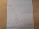
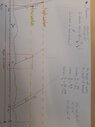
See the image to get an overview of the problem.
So far I have tried several things but I am not able to solve it by hand. (including dummie variables etc)
Maybe someone else can help me by addressing some steps/hints/...
Thanks in advance
Twan
Hi, this is my first post with a problem that I have during my Msc Project.
I will briefly discuss my project and the reason why I would like to solve this problem, if you do not want to read this part you can skip it.
I am doing experimental research on the scaled laboratory setup where I measure the changes in bottom profiles of a sediment layer under a oscillating fluid flow. Via a pattern matching technique I am able to reconstruct the bottom profile (morphodynamics) of the sediment bed.
The working principle is a beamer that projects a set of projections where white dots are being projected on top op the sediment layer ( trough the water surface ( so refraction will also be part of this problem )). The beamer is positioned under an angle and projects the pattern within my region of interest. Above this region there is a camera that makes pictures of the patterns projected by the beamer.
If the sediment profile in my region of interest changes in height, the projected image will gets distorted. The changes within the projected patterns are then used to reconstruct the ''real'' vertical change in the sediment layer.
- i have 15 pattern images ( within each pattern there are 200 white dots )
- first the 15 patterns are projected on the horizontal surface
- pictures of these patterns are taken and analysed ( i save the (x,y) coordinates of all the 200 dots for each image )
- adding a bit of sediment on the horizontal plate will result in some changes of the x coordinate of some dots
(only the x coordinate varies because the beamer is positioned in line with the x-axis)
- these changes in x coordinate * factor = vertical change.
The factor can be calculated via a calibration where a inclined plane is used, and patterns are projected. Knowing the slope of the plane it is possible to determine the factor.
Every thing is done while water is present.
While analyzing the data I found out that my calculated bed profiles have a small offset ( slope ). This is due to the fact that the projection angle varies throughout my region of interest. ---------------------------
The problem
Is there an analytical solution the the following problem:
I want to have h=h(x,H,deltax) where h is the height of my sediment layer
H is the water level (constant) and deltax is the difference between position of the projection without sediment & with sediment.
See the image to get an overview of the problem.
So far I have tried several things but I am not able to solve it by hand. (including dummie variables etc)
Maybe someone else can help me by addressing some steps/hints/...
Thanks in advance
Twan