Cascade Volcanoes and Cascadia Subduction Zone

  • Thread starter Astronuc
  • Start date
  • #1
Astronuc
Staff Emeritus
Science Advisor
21,098
5,242
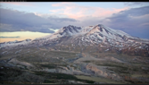
Since we often get comments on US Volcanoes, particularly those in California, Oregon and Washington State, I thought it would be worthwhile to have a separate Cascade Volcano thread.

USGS has a Cascade Volcano Observatory.
http://volcanoes.usgs.gov/observatories/cvo/

There is also a site on volcanoes.

The Eruption History of Mount Rainier
http://volcanoes.usgs.gov/volcanoes/mount_rainier/geo_hist_eruption_history.html
http://volcanoes.usgs.gov/volcanoes/mount_rainier/geo_hist_future_eruptions.html

U.S. Volcanoes and Current Activity Alerts
http://volcanoes.usgs.gov/index.html

I've read reports of geothermal activity around Mt. Rainier. I haven't seen any in person, but I hope to visit more often.

Someone took a video of steam plumes near the top.


There is an active monitoring program at Mt. Rainier and at Mt. St. Helens. I don't know much about the other volcanoes.
https://www.nps.gov/mora/learn/nature/mount-rainier-seismicity.htm

There is a separate thread about Mt. Hood.
https://www.physicsforums.com/threads/low-level-seismic-swarm-activity-at-mt-hood-oregon.872092/

Some background on the Cascadia Subduction Zone
https://en.wikipedia.org/wiki/Cascadia_subduction_zone
http://earthquake.usgs.gov/data/crust/cascadia.php [Broken]
https://www.pnsn.org/outreach/earthquakesources/csz

See also -
The orphan tsunami of 1700—Japanese clues to a parent earthquake in North America
Professional Paper 1707
https://pubs.er.usgs.gov/publication/pp1707
 
Last edited by a moderator:
  • Like
Likes DaveE, clipclop, davenn and 1 other person

Answers and Replies

  • #2
1oldman2
1,451
1,210
  • #3
clipclop
13
3
There doesn't appear to be a lot of current info on activity of the Garibaldi volcanic complex in Canada.
 
  • #5
ebos
135
48
Thanks again, Astronuc.
 
  • #7
Astronuc
Staff Emeritus
Science Advisor
21,098
5,242
There doesn't appear to be a lot of current info on activity of the Garibaldi volcanic complex in Canada.
There does seem to be a lack of information on the Garibaldi Volcanic Complex.

There is a Wikipedia article, which describes the Garibaldi Volcanic Belt as a continuation of the Cascades.
https://en.wikipedia.org/wiki/Garibaldi_Volcanic_Belt

https://en.wikipedia.org/wiki/Garibaldi_Volcanic_Belt#Geothermal_and_seismic_activity
According to that section, "at least four volcanoes have had seismic activity since 1985, including Mount Garibaldi (three events), Mount Cayley (four events), Mount Meager (seventeen events) and the Silverthrone Caldera (two events). Seismic data suggest that these volcanoes still contain active magma chambers, indicating that some Garibaldi Belt volcanoes are likely active, with significant potential hazards."
One of the references seems to no longer exist, but it is available on the Wayback Archive - http://wayback.archive.org/web/20061008200258/http://gsc.nrcan.gc.ca/volcanoes/gscvol_e.php

I looked at the Natural Resources Canada website, but only found Earth Sciences - https://www.nrcan.gc.ca/earth-sciences
https://www.nrcan.gc.ca/earth-sciences/resources/publications

It seems that they have reduced the program on volcanoes - http://chis.nrcan.gc.ca/volcano-volcan/index-en.php

Earthquakes has a bit more - http://www.earthquakescanada.nrcan.gc.ca/index-en.php

It might be worthwhile for those in Canada to contact the institution and see if they would reinstate the volcanoes portion of the site.
Geological Survey of Canada, Strategic Plan 2013-2018
http://geoscan.nrcan.gc.ca/starweb/geoscan/servlet.starweb?path=geoscan/fulle.web&search1=R=293638
 
  • Like
Likes clipclop and 1oldman2
  • #8
clipclop
13
3
There does seem to be a lack of information on the Garibaldi Volcanic Complex.

There is a Wikipedia article, which describes the Garibaldi Volcanic Belt as a continuation of the Cascades.
https://en.wikipedia.org/wiki/Garibaldi_Volcanic_Belt

https://en.wikipedia.org/wiki/Garibaldi_Volcanic_Belt#Geothermal_and_seismic_activity
According to that section, "at least four volcanoes have had seismic activity since 1985, including Mount Garibaldi (three events), Mount Cayley (four events), Mount Meager (seventeen events) and the Silverthrone Caldera (two events). Seismic data suggest that these volcanoes still contain active magma chambers, indicating that some Garibaldi Belt volcanoes are likely active, with significant potential hazards."
One of the references seems to no longer exist, but it is available on the Wayback Archive - http://wayback.archive.org/web/20061008200258/http://gsc.nrcan.gc.ca/volcanoes/gscvol_e.php

I looked at the Natural Resources Canada website, but only found Earth Sciences - https://www.nrcan.gc.ca/earth-sciences
https://www.nrcan.gc.ca/earth-sciences/resources/publications

It seems that they have reduced the program on volcanoes - http://chis.nrcan.gc.ca/volcano-volcan/index-en.php

Earthquakes has a bit more - http://www.earthquakescanada.nrcan.gc.ca/index-en.php

It might be worthwhile for those in Canada to contact the institution and see if they would reinstate the volcanoes portion of the site.
Geological Survey of Canada, Strategic Plan 2013-2018
http://geoscan.nrcan.gc.ca/starweb/geoscan/servlet.starweb?path=geoscan/fulle.web&search1=R=293638

The survey plan mentions an agency and a program but no real plan to study the volcanoes in BC.

The Canadian Hazard Information Service says, "In Canada, there is no ongoing monitoring at individual volcanoes because eruptions are so infrequent. However, Natural Resources Canada’s Canadian National Seismograph Network (CNSN) currently monitors volcanic regions in British Columbia and the Yukon and can detect very small earthquakes. If unrest were detected near a Canadian volcano, NRCan would respond by providing additional targeted monitoring of seismic activity, ground deformation, gas emissions, and other phenomena in order to find out what was happening, and would prepare hazard maps and work closely with emergency planning agencies to ensure that accurate hazard information was available. During the 2007 Nazko seismic swarm in central British Columbia, which lasted two months and did not lead to an eruption, NRCan installed additional seismic stations, took soil gas measurements to look for volcanic gas emissions, conducted field reconnaissance, and prepared a preliminary hazard map." http://chis.nrcan.gc.ca/volcano-volcan/how-comment-en.php

Following the Seismograph Network link it shows only a few probes near the Garibaldi complex but only one actually in the Complex at Whistler mountain.
http://www.earthquakescanada.nrcan....stn/index-en.php?tpl_sorting=map&CHIS_SZ=swbc
 
  • #9
Astronuc
Staff Emeritus
Science Advisor
21,098
5,242
Some background on Lassen Peak in California.
http://pubs.usgs.gov/fs/2000/fs022-00/
The composition of the molten rock (magma) that feeds volcanism in the Lassen area ranges widely in its content of silica (SiO2). When high-silica (dacite) magma rises to the Earth’s surface, it can erupt explosively to produce ash clouds and pyroclastic flows. Dacite magma extruded nonexplosively forms lava domes, because it is too viscous to flow far away from its source. Low-silica (basalt) magma is more fluid and usually erupts less explosively than dacite magma. Eruptions of basalt magma typically produce elongate lava flows, as well as build cinder cones (piles of small frothy lava fragments or “cinders”) around volcanic vents.

In the past 50,000 years, at least seven major episodes of dacitic volcanism produced lava domes and pyroclastic deposits in the Lassen area, and another five episodes produced basaltic and andesitic (silica content between basalt and dacite) lava flows. In addition, about 30 smaller volcanoes erupted basaltic lavas in the larger region surrounding the Lassen volcanic center.
 
  • #10
36,893
8,939
There is an active monitoring program at Mt. Rainier and at Mt. St. Helens. I don't know much about the other volcanoes.
I have some familiarity with the five Washington volcanoes, having climbed all of them, in addition to Hood in Oregon, and Shasta and Lassen in California.

Mt. Baker is the northern-most Washington Cascade volcano. In the 70s and early 80s Mt. Baker was emitting so much steam in that geologists were warning of potential mudslides in some of river valleys radiating from the mountain. In 1974 I remember standing on the summit of Mt. Shuksan, about six air miles from Mt. Baker, hearing the sound of the steam being vented. It sounded like a jet engine, even at that distance. Since then the activity as subsided considerably. The last time I was at the summit of Baker, it was still emitting steam, but in a greatly reduced amount.

To the south is Glacier Peak. As far as I know, there is no monitoring of this peak. Its last eruption was about 1700.

The remaining volcanoes are Mt. Rainier, Mt. St. Helens, and Mt. Adams, all of which have monitoring systems installed.
wikipedia said:
Seismic activity around Adams is very low and it is one of the quietest volcanoes in Oregon and Washington. It is monitored by the Pacific Northwest Seismic Network and the Cascades Volcano Observatory via a seismic station on the southwest flank of the mountain.
When I climbed Mt. Adams about 1984, I saw a cabin at the top of the mountain that was used by sulfur miners back in the 1920s. They used pack mules to take the sulfur down to where it could be loaded into wagons. The discovery of large deposits of sulfur in the salt domes in Louisiana that could be extracted more easily caused the operations on Mt. Adams to cease. As you can see from the picture, the cabin is almost completely choked with snow.
MtAdams 001.jpg
 
  • Like
Likes davenn, Astronuc and OmCheeto
  • #11
davenn
Science Advisor
Gold Member
9,666
9,298
I have some familiarity with the five Washington volcanoes, having climbed all of them, in addition to Hood in Oregon, and Shasta and Lassen in California....

Great info, Mark, I always enjoy the personal experience side


Dave
 
  • #12
Astronuc
Staff Emeritus
Science Advisor
21,098
5,242
The last Cascadia Subduction Zone event—Magnitude 8.0 to 9.1—was January 26, 1700 (322 years ago), and they happen about every 280 to 350 years. It’s time to get ready.

Still waiting . . . .

https://extension.oregonstate.edu/cascadia-earthquake-preparedness

Small stuff happening. The strongest one in the region during the last 30 days happened today.
https://earthquake.usgs.gov/earthquakes/eventpage/us6000fx7p/executive

M 4.7 - 160 km W of Langlois, Oregon​

  • 2021-10-24 12:11:40 (UTC)
  • 43.179°N 126.395°W
  • 10.0 km depth
 
  • #13
Astronuc
Staff Emeritus
Science Advisor
21,098
5,242
Interesting article on Mt. St. Helens.
https://www.nationalgeographic.com/...ere-should-be-scientists-may-finally-know-why
Mount St. Helens sits oddly apart from the other Cascade Volcanoes.
I don't necessarily agree with the statement. One can often find exceptions to arbitrary rules/trends.

https://imush.pnsn.org/
iMUSH is a four year collaborative research project involving several institutions and supported by the GeoPRISMS and EarthScope Programs of the US National Science Foundation to illuminate the architecture of the greater Mount St. Helens magmatic system from slab to surface.

iMUSH-MT is a three-dimensional electrical resistivity model for southwest Washington centered upon Mount St. Helens.
https://ds.iris.edu/ds/products/emc-imush-mt/


http://www.usarray.org/researchers/obs/flexible/deployments/imush/
 
Last edited:

Suggested for: Cascade Volcanoes and Cascadia Subduction Zone

Replies
1
Views
119
  • Last Post
Replies
4
Views
755
Replies
1
Views
444
Replies
2
Views
438
Replies
4
Views
106
Replies
7
Views
171
Replies
1
Views
171
  • Last Post
Replies
2
Views
615
Replies
39
Views
3K
Replies
2
Views
1K
Top