Iceland warming up again - quakes swarming
- Thread starter davenn
- Start date
Join the discussion
Registration is free. Ask a follow-up in this thread, or start your own.
74 replies · 19K views
Discussion
Earth sciences news on Phys.org
Admin
- 69,761
- 25,584
It looks like they shut down the Blue Lagoon resort now, because the earthquakes are increasing...
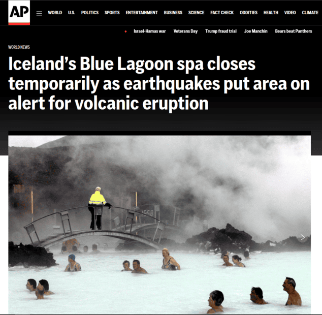
https://apnews.com/article/blue-lag...t-attraction-96b8fb04f289d261abde82751fdd1ae5
https://apnews.com/article/blue-lag...t-attraction-96b8fb04f289d261abde82751fdd1ae5
Staff Emeritus
Science Advisor
Gold Member
2025 Award
- 22,696
- 7,784
Significant damage to roads around Grindavik.
https://www.msn.com/en-us/weather/t...-to-concerns-of-volcanic-eruption/vi-AA1jNezZ
https://www.msn.com/en-us/weather/t...y-due-to-volcanic-eruption-threat/vi-AA1jN9Qs
https://en.vedur.is/about-imo/news/a-seismic-swarm-started-north-of-grindavik-last-night
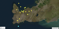
Swarm of earthquakes in SW Iceland, west of Grundavik, including Mag 5 off the coast.
https://earthquake.usgs.gov/earthquakes/eventpage/us7000la6d/executive
https://www.msn.com/en-us/weather/t...-to-concerns-of-volcanic-eruption/vi-AA1jNezZ
https://www.msn.com/en-us/weather/t...y-due-to-volcanic-eruption-threat/vi-AA1jN9Qs
https://en.vedur.is/about-imo/news/a-seismic-swarm-started-north-of-grindavik-last-night
Since the morning of November 11th, seismic activity related to the magma intrusion remains fairly constant. Since midnight November12th, around 1000 earthquakes have been recorded within the dyke, and all of them have been below M3.0 in magnitude. The most seismic activity has been located in the region north of Grindavík. Most of the earthquakes are at a depth of 3-5km corresponding to the lower part of the dyke intrusion.
GPS measurements covering the past 24 hours show that deformation associated with the dyke intrusion that formed on Friday, November 10th has slowed. This can be an indication that magma is moving closer to the surface, new models will be run as soon as new data comes in to update the model.
It was a joint assessment from the meeting, based on the latest data, that there is scope for temporary measures under the control of the Department of Civil Protection and Emergency Management to collect necessities for the residents and attend to urgent errands in Grindavík and the surrounding area.
Swarm of earthquakes in SW Iceland, west of Grundavik, including Mag 5 off the coast.
https://earthquake.usgs.gov/earthquakes/eventpage/us7000la6d/executive
M 5.0 - 9 km SW of Grindavík, Iceland
- 2023-11-10 18:09:00 (UTC)
- 63.773°N 22.554°W
- 10.0 km depth
- Interactive Map
Attachments
Last edited:
Staff Emeritus
Science Advisor
Education Advisor
Gold Member
Dearly Missed
- 35,014
- 21,725
I'm not a geologist, but isn't it better to have multiple small earthquakes and eruptions ands release the energy that way than to have one big one?
Staff Emeritus
Science Advisor
Gold Member
2025 Award
- 22,696
- 7,784
I think it's more that the earthquakes are indicative of a magma chamber close to the surface.Vanadium 50 said:I'm not a geologist, but isn't it better to have multiple small earthquakes and eruptions ands release the energy that way than to have one big one?
https://www.msn.com/en-us/weather/t...wn-as-a-volcano-prepares-to-erupt/ar-AA1jM1GeMagma is continuing its approach to the town, prompting authorities to order an evacuation. The roads leading to Grindavik are currently closed, with inhabitants of the southwest portions being the first to leave. The Icelandic Civil Defense Agency emphasizes that this evacuation is purely precautionary.
Recent reports indicate that the magma tunnel has reached the town and crossed the coastline. It is now expanding under the sea. The Icelandic Meteorological Office predicts an eruption near Sundhnjúkagígar, north of Grindavik, could occur soon.
It's not just a single volcanic vent, but a very long miles/km fissure that may rupture, i.e., a magma intrusion erupting over miles, and possibly through the town of Grindavik. Of course, lava is flowing from the Fagradalsfjall volcano, which one of 6 volcanic systems in the Reykjanes Peninsula.
The artlcle emphasizes that the location of the Fagradalsfjall volcano was dormant for nearly 800 years. Since 2021, the volcanic system has erupted twice, and seismic activity has spread over a larger area, and in the village of Gridavik. There is some mention of uplifting of the ground, but I don't know the extent (breadth) of the uplift. Someone mentioned 3 inches (7.6 cm), but it could be more or less depending on location.
Staff Emeritus
Science Advisor
Gold Member
2025 Award
- 22,696
- 7,784
https://www.msn.com/en-us/weather/t...cuates-ahead-of-possible-eruption/vi-AA1jMT1jAn interesing perspective on Greenland and Iceland.
https://www.msn.com/en-us/news/technology/iceland-comes-from-greenland/vi-AA1jLXxu
So, Iceland sits over a geologic hotspot in the earth's crust/mantle, over which Greenland passed millions of years ago. As I understand it, Iceland sits on the mid-Atlantic Ridge, which is the boundary between the North Amercian Plate and the Eurasia Plate. The mid-Atlantic Ridge is a "divergent or constructive plate boundary", which means the two plates are moving apart, and magma occasionally rises to the surface, as in the case of Iceland.
https://en.wikipedia.org/wiki/Mid-Atlantic_Ridge#/media/File:Iceland_Mid-Atlantic_Ridge_map.svg
Islands form along the ridge.
https://en.wikipedia.org/wiki/Mid-Atlantic_Ridge#Islands
https://en.wikipedia.org/wiki/Mid-Atlantic_Ridge#Iceland
The submarine section of the Mid-Atlantic Ridge close to southwest Iceland is known as the Reykjanes Ridge. The Mid-Atlantic Ridge runs through Iceland where the ridge is also known as the Neovolcanic Zone. In the north of Iceland the Tjörnes Fracture Zone connects Iceland to the Kolbeinsey Ridge.
I suppose some additional information/updating is forthcoming as events unfold. Ostensibly, Iceland is growing - getting wider (east-west), as well as vertically.Edit/update: https://www.msn.com/en-us/weather/t...-over-threat-of-volcanic-eruption/vi-AA1jQrPb
https://www.msn.com/en-us/news/technology/iceland-comes-from-greenland/vi-AA1jLXxu
So, Iceland sits over a geologic hotspot in the earth's crust/mantle, over which Greenland passed millions of years ago. As I understand it, Iceland sits on the mid-Atlantic Ridge, which is the boundary between the North Amercian Plate and the Eurasia Plate. The mid-Atlantic Ridge is a "divergent or constructive plate boundary", which means the two plates are moving apart, and magma occasionally rises to the surface, as in the case of Iceland.
https://en.wikipedia.org/wiki/Mid-Atlantic_Ridge#/media/File:Iceland_Mid-Atlantic_Ridge_map.svg
Islands form along the ridge.
https://en.wikipedia.org/wiki/Mid-Atlantic_Ridge#Islands
https://en.wikipedia.org/wiki/Mid-Atlantic_Ridge#Iceland
The submarine section of the Mid-Atlantic Ridge close to southwest Iceland is known as the Reykjanes Ridge. The Mid-Atlantic Ridge runs through Iceland where the ridge is also known as the Neovolcanic Zone. In the north of Iceland the Tjörnes Fracture Zone connects Iceland to the Kolbeinsey Ridge.
I suppose some additional information/updating is forthcoming as events unfold. Ostensibly, Iceland is growing - getting wider (east-west), as well as vertically.Edit/update: https://www.msn.com/en-us/weather/t...-over-threat-of-volcanic-eruption/vi-AA1jQrPb
Last edited:
Staff Emeritus
Science Advisor
Gold Member
2025 Award
- 22,696
- 7,784
https://www.yahoo.com/lifestyle/volcanic-fears-river-magma-cuts-073735840.htmlA 15-kilometer- (nine-mile-) long magma corridor now stretches from just northwest of Grindavík into the Atlantic Ocean, according to the Civil Protection Agency, which used models built from data collected in the area on Saturday.
Fissures have opened up around Grindavik. There is concern about SO2 being released into the air around Grindavik.
Edit/update:
https://www.washingtonpost.com/weat...d-volcano-grindavik-reykjanes-fagradalsfjall/Icelandic officials have evacuated the town of Grindavik, warning that a volcanic eruption is imminent. Cracks have appeared in the earth there, snaking under buildings, splitting streets and pouring steam into the air. And while magma hasn’t yet bubbled to the surface, experts say it probably will soon.
Last edited:
Staff Emeritus
Science Advisor
Gold Member
2025 Award
- 22,696
- 7,784
Volcanic Iceland is rumbling again as magma rises − a geologist explains eruptions in the land of fire and ice
https://theconversation.com/volcani...-eruptions-in-the-land-of-fire-and-ice-217671Radar satellite data from the Icelandic Meteorological Office show that a broad area around Grindavík sank by about 3 feet (1 meter) over 10 days, and the GPS station in town moved about 3 feet (1 meter) to the southeast with respect to the North American plate from Oct. 28 to Nov. 9. Large cracks have broken streets and houses in Grindavík.
Where the lava reaches the surface is the concern aside from the ongoing seismic activity. In a figure showing the rise and fall of the land, Grindavik is east of the land that had the greatest level of subsidence. Interesting there are red spots in the purple that would indicate rising locations is an area that mostly subsided. Or, could that be noise? A ridge east of Grindavik has risen.The Grindavík dike appeared to have reached within about 0.6 miles (1 kilometer) of the surface by Nov. 14 and could soon reach the surface.
Iceland derives 30% of its electricity from geothermal sources that use underground heat to drive turbines and produce power.
A hydrothermal plant called Svartsengi, near Grindavík, uses the underground heat to provide hot water for several thousand homes plus 75 megawatts of electricity.
. . .
That power plant is also part of the reason the Blue Lagoon is so popular. When the power plant was built in 1976, the plan was to discharge its still hot wastewater into an adjacent low area, expecting that it would seep into the ground. However, the geothermal water was loaded with dissolved silica, which turned to minerals when the water cooled, creating an impermeable layer. A small lake began to form.
Because of its high silica content, the water in this lake is a spectacular blue color that inspired the creation of the geothermal spa. The Blue Lagoon is now one of the top tourist attractions in the country.
Science Advisor
- 1,567
- 5,225
- 19,986
- 11,102
My wife and I visited last year and became friends with a hiking guide. He sent us some wild photos of roads totally wrecked. Fingers crossed for our Iceland friends!
Staff Emeritus
Science Advisor
Gold Member
2025 Award
- 22,696
- 7,784
Some uplifting north and west of Grindavik may indicates a rise in magma.
https://www.msn.com/en-us/weather/t...rise-radar-images-eruption-latest/ar-AA1kiDYZ
https://www.msn.com/en-us/weather/t...rise-radar-images-eruption-latest/ar-AA1kiDYZ
Using radar imagery taken over the weekend, the Icelandic Met Office said there had been a "significant crustal uplift" near Svartsengi, a geothermal hotspot on a southwestern cape on the island, near the capital Reykjavik, which was "indicative of a deep inflation" taking place. The ground has moved upwards by as much as three centimeters.
Staff Emeritus
Science Advisor
Gold Member
2025 Award
- 22,696
- 7,784
As of November 23, The National Police Commissioner of Iceland has downgraded the Civil Protection Alert Phase from Emergency to Alert over seismic activity on the Reykjanes Peninsula.
https://www.visiticeland.com/article/seismic-activity-on-the-reykjanes-peninsula-iceland-2023
Relatively quiet at the moment.
https://en.vedur.is/earthquakes-and-volcanism/earthquakes/reykjanespeninsula/
https://www.visiticeland.com/article/volcano-info
https://www.visiticeland.com/article/seismic-activity-on-the-reykjanes-peninsula-iceland-2023
Relatively quiet at the moment.
https://en.vedur.is/earthquakes-and-volcanism/earthquakes/reykjanespeninsula/
https://www.visiticeland.com/article/volcano-info
Science Advisor
- 1,567
- 5,225
I hope this is real video of the event.
https://www.ruv.is/frettir/innlent/2023-12-18-eldgosid-ur-thyrlu-landhelgisgaeslunnar-399992
A Coast Guard helicopter flew over the eruptions this evening with scientists and civil defense representatives. Bragi Valgeirsson, RÚV's cinematographer, was with us and captured these images of the beginning of the eruption.
Last edited:
Staff Emeritus
Science Advisor
Gold Member
2025 Award
- 22,696
- 7,784
That's impressive. The eruption fissure is about 2.5 miles (4 km) long. Apparently, where the lava will flow is not yet clear, but it could threaten Grindavik and the nearby power station.
https://www.nytimes.com/2023/12/18/world/europe/iceland-volcano-eruption-earthquakes.html
https://www.nytimes.com/2023/12/18/world/europe/iceland-volcano-eruption-earthquakes.html
The location of the fissure, which is some 2.5 miles long and growing quickly, is not far from the Svartsengi Power Plant and the town of Grindavík, which was evacuated last month because of heightened seismic activity, leading to concerns than an eruption was likely.
In the initial assessment Monday night, volcanologists had said that the eruption had occurred in one of the worst possible locations, posing a significant and immediate threat to both the evacuated town and the geothermal power plant.
But after volcanologists had a chance to fly over the site of the eruption in the Reykjanes Peninsula, the immediate situation did not appear as dire as initially feared, though the size of the eruption was larger than anticipated and the direction of the lava’s flow still unpredictable.
Staff Emeritus
Science Advisor
Gold Member
2025 Award
- 22,696
- 7,784
https://www.msn.com/en-us/weather/t...lava-bed-map-as-tongue-flows-west/ar-AA1lNZsL
The lava flow has decreased somewhat. The lava fountains have decreased in height.Edit/update: (Sat, 23 Dec) - Iceland’s Fagradalsfjall volcano spewed more lava on Wednesday as engineers worked to divert the flow away from the Svartsengi power plant.
https://apnews.com/video/volcanoes-...nal-national-6da7153e7e3e4ba4b4ef118ccb7f4116
The lava flow has decreased somewhat. The lava fountains have decreased in height.Edit/update: (Sat, 23 Dec) - Iceland’s Fagradalsfjall volcano spewed more lava on Wednesday as engineers worked to divert the flow away from the Svartsengi power plant.
https://apnews.com/video/volcanoes-...nal-national-6da7153e7e3e4ba4b4ef118ccb7f4116
Last edited:
Staff Emeritus
Science Advisor
Gold Member
2025 Award
- 22,696
- 7,784
Iceland Volcano Update: New Eruption Warning Issued
https://www.msn.com/en-us/weather/t...pdate-new-eruption-warning-issued/ar-AA1m92RNA horizontal intrusion of magma—around 6 miles in diameter—has been building under the peninsula since November 10, and is thought to be channeling magma into a vertical intrusion—estimated to be around 9.3 miles long—near the coastal fishing town of Grindavik.
Swarms of seismic activity led to anticipation that a volcanic event was set to occur, with magma likely propagating to the surface through the vertical dike. That occurred on Monday, December 18, with lava shooting up to 650 feet into the air from five fissures in the initial phase of the eruption.
Ben Edwards, an American volcanologist who has visited the Reykjanes Peninsula multiple times, previously told Newsweek that the eruption could mark the start of over a century of volcanic activity in the region.
His remarks came after a leading Icelandic volcanologist told Newsweek that after a dormant period, the activity leading up to the eruption could mark the start of an "intense" period of "rifting and volcanism" on the peninsula.
Iceland could be growing. I wonder of the volcanism will propagate northward as well as southward.
Flyboy
Gold Member
- 426
- 633
It’s here again. Eruption started a few hours ago, much closer to Grindavík this time, with the first fissure actually cutting directly through the lava barrier they’d built over the last two months, and a second fissure opening right next to the edge of town. Reports seem to indicate that there’s been another 70-80 centimeters of layers displacement under the town as well.
Doesn’t look very promising for the town right now.
Edit: forgot to add the video.
Doesn’t look very promising for the town right now.
Edit: forgot to add the video.
Staff Emeritus
Science Advisor
Gold Member
2025 Award
- 22,696
- 7,784
Flyboy said:Doesn’t look very promising for the town right now.
In the last part of the video, it looks like a small fissure is opening within 100 m or closer to the northern border of the town. The narrator mentions that someone fell into a fissure, but was not found!
Ref: https://en.vedur.is/about-imo/news/a-seismic-swarm-started-north-of-grindavik-last-nightAn eruptionstarted at 7:57 UTC
The fissureopening is southeast of Hagafell mountain.
Thesouthern most part of the fissure is about 900 m from the town of Grindavík.
The openingis south of lava flow deflection barriers that are being built north ofGrindavík. Lava is now flowing towards the town.
I'm wondering if the sub-surface lava is pushing southward, or a fissure/fault is simply opening or 'unzipping' toward Grindavik.
Flyboy
Gold Member
- 426
- 633
Yeah, contractor working on backfilling a fissure. He was using a soil compactor and the ground opened up beneath him. They spent three days trying to find him and weren’t successful. They did, however, find out the fissures at the surface are actually quite sizable underneath and issued evacuation orders effective Monday. Looks like they were a little bit late.Astronuc said:The narrator mentions that someone fell into a fissure, but was not found!
There’s evidence for both. Best hypothesis right now is that the November 10th dike has been reactivated by fresh magma intrusion. That one is believed to have extended out under the ocean but they can’t confirm it.Astronuc said:I'm wondering if the sub-surface lava is pushing southward, or a fissure/fault is simply opening or 'unzipping' toward Grindavik.
The site Grindavík is built on is known to have at least one sizable fracture through it, and if memory serves, it’s from an eruption in the area in the 1300s. 1950s era aerial photography seems to imply that they backfilled at least one pretty significant surface fissure, and it seems that the same fissure activated in November during that ground movement crisis. They’re pretty confident that the dike is running through that weak spot, although the current surface vents of the eruption seem to be displaced from that fissure. I’m curious to see what the Icelandic Met Office has to say.
https://en.vedur.is/about-imo/news/a-seismic-swarm-started-north-of-grindavik-last-night
Page will update with official reports from the IMO as they give press briefings. Given the dynamic situation, it can be pretty far behind what’s actually happening at the moment, but the graphics showing activity and locations are quite useful.
Staff Emeritus
Science Advisor
Gold Member
2025 Award
- 22,696
- 7,784
The Mid-Atlantic Ridge runs right through Iceland, and it seems to fork east of Reykjavik, with a western branch running along the Reykjanes peninsula, which seems to have multiple faults or intrusions, including one that passes through Grindavik.
https://geologictimepics.files.wordpress.com/2018/09/iceland2geomapplates.jpg
From Comments on the figure:
Ref: https://geologictimepics.com/2018/0...-atlantic-rift-and-some-other-geology-photos/
At 1500 local time, it appears lava has reached some houses.
https://www.bbc.com/news/live/world-europe-67973655
On the BBC page, there is a comment (1400 local): New fissure opens just north of Grindavik, with lava 50m from town
That would be the one I cited above 100 m or closer. So, it was closer - 50 m.
By 1430 local time, it looks like lava from the fissure 50 m from the town had reach nearby houses..
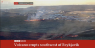
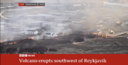
The BBC live stream shows the fissure near the town. Within one hour, the lava had read houses on the edge of town. Two images are from 1406 and 1505 showing how quickly the situation changes.
https://geologictimepics.files.wordpress.com/2018/09/iceland2geomapplates.jpg
From Comments on the figure:
New material erupts in the rift zones as they pull apart, separating the two major tectonic plates. In Iceland there’s a third microplate between the two rifts. The process continues through time, creating volcanic activity with ages somewhat symmetrical about each of the rifts. From the map, you can also see that most of Iceland’s big thermal areas lie within the rift zones.
Ref: https://geologictimepics.com/2018/0...-atlantic-rift-and-some-other-geology-photos/
At 1500 local time, it appears lava has reached some houses.
https://www.bbc.com/news/live/world-europe-67973655
On the BBC page, there is a comment (1400 local): New fissure opens just north of Grindavik, with lava 50m from town
That would be the one I cited above 100 m or closer. So, it was closer - 50 m.
By 1430 local time, it looks like lava from the fissure 50 m from the town had reach nearby houses..
The BBC live stream shows the fissure near the town. Within one hour, the lava had read houses on the edge of town. Two images are from 1406 and 1505 showing how quickly the situation changes.
Attachments
Last edited: