Mag 6.4, Triple Point -Juan de Fuca (Gorda), N America, Pacific Plates

Join the discussion
Ask a follow-up here, or get your own question answered by working scientists, mathematicians and engineers — people, not an autocomplete.
Real named experts · corrections over time · the nuance an AI answer skips
7 replies · 3K views
Messages
22,643
Reaction score
7,696

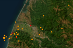
M 6.4 - 12km WSW of Ferndale, CA​

https://earthquake.usgs.gov/earthquakes/eventpage/nc73821036/executive
  • 2022-12-20 10:34:25 (UTC)
  • 40.523°N 124.393°W
  • 16.1 km depth
https://en.wikipedia.org/wiki/Juan_de_Fuca_Plate#/media/File:Juan_de_fuca_plate.png

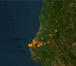
Numerous aftershocks (Mag 2-4) occurring inland. Power outages reported in Humboldt county.

M 4.6 - 6km WNW of Rio Dell, CA​

  • 2022-12-20 10:39:02 (UTC)
  • 40.515°N 124.174°W
  • 24.2 km depth

According to PowerOutage.us, more than 70,000 people across Humboldt County, a majority of residents, were without power early Tuesday. Pacific Gas & Electric was working to restore power, Karges said, adding that "there is no time available" for when services might come back online.
https://www.yahoo.com/news/magnitude-6-4-earthquake-strikes-111116652.html
State Route 11 at Fernbridge, the county’s oldest bridge, was closed early Tuesday because the bridge was cracked in four places, according to the California Highway Patrol incident log. Pictures on Twitter showed the concrete was fractured in several places. Crews were dispatched for an integrity check, Carsey said.

Exactly a year ago, the same area was hit by a magnitude 6.2 quake that shattered windows and caused some damage.
 

Attachments
  • Ferndale_Earthquakes2022-12-20_05-09-09.png
    Ferndale_Earthquakes2022-12-20_05-09-09.png
    98.6 KB · Views: 178
  • Ferndale_Earthquakes2022-12-20_05-27-47.png
    Ferndale_Earthquakes2022-12-20_05-27-47.png
    126.1 KB · Views: 192
Last edited:
Reply
  • Like
Likes   Reactions: davenn
Earth sciences news on Phys.org
Last edited:
Reply
  • Sad
Likes   Reactions: Astronuc
There was an M6.8 earthquake near Olympia, WA on Feb. 28, 2001, caused most likely by movement of the same plate, the Juan de Fuca plate. I remember that quake distinctly, as I was driving south on I-405 when I felt the whole highway moving under me for about 10 seconds. I thought there was something wrong with my car, but found out later that it was an earthquake.
 
Scientists have discovered a massive tear in the tectonic plate off the coast of Vancouver Island. This "rip" suggests that the northern end of the Cascadia Subduction Zone is actually starting to shut down. The CBC’s Johanna Wagstaffe investigates what this discovery might mean for the "Big One" off the coast of Vancouver Island.
https://www.cbc.ca/player/play/video/9.7107713

The 'Explorer Plate' is east of an active ocean ridge, which is pushing out 'new' ocean crust of the north coast of Vancouver Island, BC, Canada.

Earth’s Crust Is Tearing Apart off the Pacific Northwest—and That’s Not Necessarily Bad News
https://en.wikipedia.org/wiki/Explorer_plate

https://news.climate.columbia.edu/2...northwest-and-thats-not-necessarily-bad-news/

https://pnsn.org/education/pnw-earthquakes/sources/cascadia
 
Reply
  • Like
Likes   Reactions: davenn and BillTre