Three Sisters Volcano - Ongoing Magmatic Intrusion

  • Thread starter Thread starter Astronuc
  • Start date Start date
  • Tags Tags
    Volcano
Click For Summary

Discussion Overview

The discussion centers on the ongoing magmatic intrusion at Three Sisters Volcano, exploring its geological characteristics, historical context, and comparisons with other volcanic activity in the region. Participants share personal experiences and observations related to volcanic activity, as well as references to past eruptions and current monitoring techniques.

Discussion Character

  • Exploratory
  • Technical explanation
  • Historical

Main Points Raised

  • Some participants note that the magma composition at Three Sisters appears to be basaltic.
  • One participant compares the threat level of Three Sisters to that of Cumbre Vieja, suggesting a perception of greater danger from the latter.
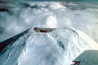
  • Another participant shares a personal anecdote about visiting the Dee Wright Observatory and climbing nearby volcanic peaks, emphasizing the geological features of the area.
  • There is mention of improved monitoring techniques for volcanic activity since the eruption of Mt. St. Helens, with some participants discussing the implications of these advancements for understanding magmatic intrusion at Three Sisters.
  • Historical references are made to the initial eruption of Mt. St. Helens, including details about the events leading up to the major eruption and the public response at that time.
  • Participants recount personal climbing experiences on various mountains, including Mt. St. Helens and Mt. Rainier, and discuss the conditions and challenges faced during those climbs.
  • Some participants express concerns about the potential for volcanic eruptions and associated hazards in the Cascade range, referencing past activity at Mt. Baker and its implications for nearby communities.

Areas of Agreement / Disagreement

Participants do not reach a consensus on the relative threat posed by Three Sisters compared to other volcanoes, and there are multiple perspectives on the implications of historical eruptions and current monitoring capabilities. The discussion remains unresolved regarding the overall risk assessment of the Three Sisters Volcano.

Contextual Notes

Participants reference various historical events and personal experiences, which may introduce subjective interpretations of volcanic activity. The discussion includes anecdotal evidence and observations that may not be universally applicable or verified.

Astronuc
Staff Emeritus
Science Advisor
Gold Member
2025 Award
Messages
22,526
Reaction score
7,503
  • Informative
  • Like
Likes   Reactions: Jarvis323, davenn, OmCheeto and 2 others
Earth sciences news on Phys.org
The list near the end (3:47) with the Cumbre Vieja at level 10 is far more frightening than the 3 sisters, it seems.
 
  • Like
Likes   Reactions: BillTre and Astronuc
Quite a few years ago, while returning from climbs of Mt. Shasta and Mt. Lassen, in northern California, I made a side trip over McKenzie Pass, which is just north of the Three Sisters. At the pass is a visitor center called the Dee Wright Observatory. It's situated in a lava flow, and is a circular building made from the aa lava in the flow. The wall of the building has holes that are oriented toward the nearby volcanic peaks -- the Three Sisters, Mt. Jefferson, Mt. Hood, Mt. Bachelor, and so on. While I was there I walked up Belknap Crater (really not more than a pimple) and Belknap Peak, a larger lump of loose volcanic material.
 
  • Like
Likes   Reactions: davenn, BillTre, Klystron and 1 other person
These days, we have a lot better knowledge of what is going on underground, and our instrumentation is a lot better.

I read a post about the initial eruption of Mt St Helens, which wasn't much of an eruption of 27 March, 1980, or 43 years ago.

Mar 27, 1980: Portland Radio-KGW’s airplane flies off from Vancouver’s Pearson Airpark at 12:35 pm. “We break through clouds at 6,700 feet and see Mount St. Helen’s upper 3,000 feet,” reporter Mike Beard says. “The summit is oddly dark. As we draw near, I see a crater two hundred feet across—a hole in the ice, black ash around it. It is clearly new.” As the Eagles finish singing “I Can’t Tell You Why”, Beard announces on the airwaves there is no doubt volcanic activity has begun.

USGS officials issue a Hazards Watch to public officials. Concerns over the potential for large rock avalanches and widespread flooding prompt evacuations within a 15-mile radius from the volcano. At Spirit Lake, 45 people are moved, mostly reporters and scientists, but lodge owner Harry Truman remains. Deputies from Cowlitz and Skamania Counties set up roadblocks on several main routes to keep out the curious.

At 2:00 pm, the Pacific Northwest Seismic Network's seismology lab records a magnitude 4.7 earthquake, the second strongest to-date. The quake was one of 57 during the day to register M3.5 or greater.

This aerial image is of the summit area at Mount St. Helens on March 27, 1980, showing the newly formed crater (about 200 to 250 ft wide and about 80 to 100 ft deep) and a swath of dark new ash. Photo by USGS scientist David Frank.
Reporter Mike Beard in 2010 on the initial Mt St Helens eruption.
https://www.oregonlive.com/opinion/2010/03/mount_st_helens_eruption_broad.html
Living along the western coast of the US, one should be aware of the potential for earthquakes and volcanic eruptions. Since Mt St Helens erupted, there are improved observations in the Cascade range, and there is some evidence of venting on Mt Rainier and magmatic intrusion at Three Sisters. The normally passive systems can become dynamic very quickly.

From a Wikipedia article, "A series of phreatic blasts occurred from the summit and escalated until a major explosive eruption took place on May 18, 1980, at 8:32 AM," which was 52 days after the initial observations of the small eruption and development of a crater at the top on 27 March.

https://www.usgs.gov/volcanoes/mount-st.-helens/1980-cataclysmic-eruption
 

Attachments

  • MtStHelens_27Mar1980(USGS).jpg
    MtStHelens_27Mar1980(USGS).jpg
    63.1 KB · Views: 152
  • Like
Likes   Reactions: davenn and BillTre
Astronuc said:
I read a post about the initial eruption of Mt St Helens, which wasn't much of an eruption of 27 March, 1980, or 43 years ago.
I was on the summit of Mt. St. Helens in the summer of '74. Lots of people were up there, including a couple who had a small poodle, and a guy who yodeled very proficiently. Around Jan. 3, 1979, a friend and I camped out in the Spirit Lake parking lot with a low temp of about 5° F. The cold temperature led to a late start, so we made it only to a feature known as the Sugar Bowl, a minor bump on the side of the mountain.
We set off the next morning, using crampons on the rock-hard snow. We made it only to about 8300' of the then-9700' mountain, as the weather had warmed up quite a bit, and the low clouds merged with higher clouds so that we were in whiteout conditions. We had brought about 50 wands with us, but after we had used them all up, we decided to abort the climb. If the weather had stayed cold, we probably would have made it to the summit. I was fine with calling off the climb, as I had been to the top a few years earlier. My climb partner came back a few months later to complete his climb.

Astronuc said:
Since Mt St Helens erupted, there are improved observations in the Cascade range, and there is some evidence of venting on Mt Rainier and magmatic intrusion at Three Sisters.
When I was in the Army at Ft. Lewis (near Tacoma, WA) in the late 60s, a guy in my outfit talked about climbing Rainier and spending the night in a steam cave at the summit. Many years later I made it to the summit with a group of three other guys. It was mid-August, but the temps were in the 20s and the wind was blowing at about 10 mph, so we decided not to hang around the summit, not even to sign in at the summit register. During out short stay at the summit, I didn't notice any steam caves, but I suspect that they still were there. If we had stopped to take a break and sign in, we would have needed to put on more clothes, which would have required us take off our coats to do so. Being sweaty from climbing, we would have gotten very chilled.

Mt. Baker, another volcano near the border with Canada, was also restive during the 70s. Many geologists were concerned that it could erupt, and produce mudflows that threatened nearby towns and cities. In July of '74 I was with a group of friends on the summit of Mt. Shuksan, a nearby non-volcanic mountain about 10 air miles away from Mt. Baker. The steam being released by Mt. Baker sounded like the roar of a jet engine, even at that distance. Since then, Mt. Baker has quieted down.
 
Last edited:
  • Like
Likes   Reactions: davenn, Astronuc and BillTre

Similar threads

Replies
1
Views
2K
Replies
2
Views
4K
Replies
1
Views
3K
Replies
1
Views
4K
  • · Replies 41 ·
2
Replies
41
Views
12K
Replies
1
Views
4K
  • · Replies 0 ·
Replies
0
Views
2K
  • · Replies 1 ·
Replies
1
Views
2K
  • · Replies 3 ·
Replies
3
Views
3K