2018-10-18 Significant storms around Sydney, Australia

In summary, the last couple of days, 17th and 18th Oct have produced some severe thunderstorms in the Sydney basin and surrounding region.
  • #1
davenn
Science Advisor
Gold Member
2023 Award
9,590
10,269
the last couple of days, 17th and 18th Oct have produced some severe thunderstorms in the Sydney basin and surrounding region.
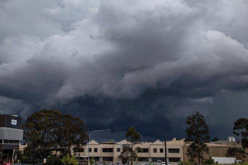
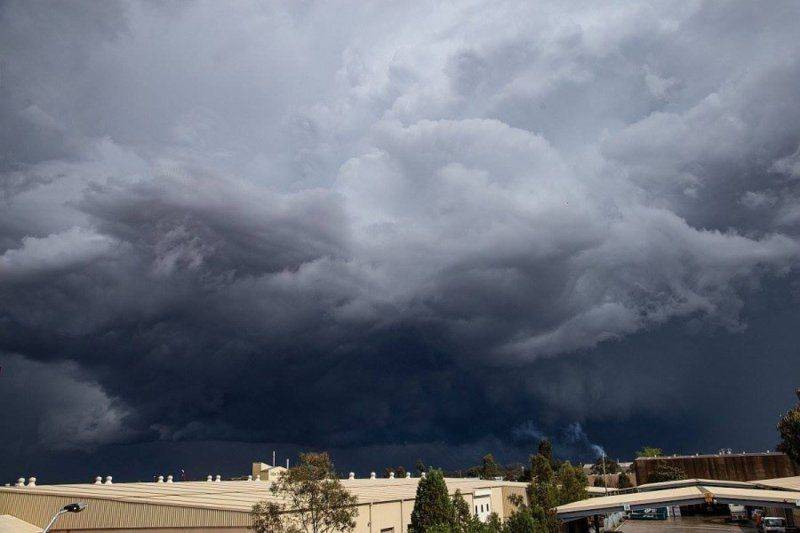
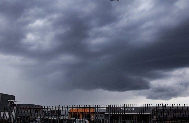
Here's several photos I did from yesterday's activity from my work place in western Sydney ( out towards Penrith)

Intense lightning, heavy rain and surface flooding and some hail

Those second two pic's really show the storm at its menacing worst.
181018 storm1.jpg

181018 storm2a.jpg

181018 storm2b.jpg

Dave
 

Attachments

  • 181018 storm1.jpg
    181018 storm1.jpg
    34.6 KB · Views: 620
  • 181018 storm2a.jpg
    181018 storm2a.jpg
    42.1 KB · Views: 606
  • 181018 storm2b.jpg
    181018 storm2b.jpg
    39 KB · Views: 702
  • Like
Likes BillTre
Earth sciences news on Phys.org
  • #2
Wowie. Is this typical, or have you been seeing increases the last few years like North America?
 
  • Like
Likes davenn
  • #3
Reasonably typical, the last ~ 3 years have been below par for the greater Sydney basin area. most of the best activity has been mainly to the north of us, towards the tropics.
so finally seeing some respectable stuff again … bad for the residents ( me included) and insurance
companies, but great for us storm chasers ( me included).
Tomorrow, Saturday 20th is looking pretty good from the predictions and we are supposed to be
having a local chasers get-together tomorrow nite at home … beer, pizza and lots of good chase
stories and videos :smile:tomorrow's settings …….

The first one is the CAPE

upload_2018-10-19_19-58-14.png
  1. Convective available potential energy - Wikipedia
    https://en.wikipedia.org/wiki/Convective_available_potential_energy
    168159a3.png
    f9bbbf72.png

    Overview
    In meteorology, convective available potential energy (CAPE), is the amount of energy a parcel of air would have if lifted a certain distance vertically through the atmosphere. CAPE is effectively the positive buoyancy of an air parcel and is an indicator of atmospheric instability, which makes it very valuable in predicting severe weather. It is a form of fluid instability found in thermally stratified atmospheres in which a colder fluid overlies a warmer one. An air mass will rise if it is less dense than the surrounding air (its buoyant force is greater than its weight). This can create vertically developed clouds due to the rising m…
Anything over 1000 J/kg is good. In those deepest red areas it's over 2000 J/kg. Whilst 2000+ is very good that things really get explosive
and severe lightning storms can be expected.

The next thing we look at is the LI, Lifted Index...…

upload_2018-10-19_20-21-12.png
Lifted index
From Wikipedia, the free encyclopedia

Computer generated Lifted Index field from April 6th, 2009, at 1 pm EDT. Unstable areas are in yellow (slightly) and red (highly) while the stable zone is in blue.
The lifted index (LI) is the temperature difference between the environment Te(p) and an air parcel lifted adiabatically Tp(p) at a given pressure height in the troposphere (lowest layer where most weather occurs) of the atmosphere, usually 500 hPa (mb). The temperature is measured in Celsius. When the value is positive, the atmosphere (at the respective height) is stable and when the value is negative, the atmosphere is unstable.

Determining LI[edit]
LI can be computed using computer algorithms but can also be determined graphically. To do this, generally, the parcel is lifted from the portion of the planetary boundary layer (PBL) that lies below the morning inversion. The air here should be about 60 to 65% RH, which is then lifted along the dry adiabat (see also adiabatic process) to the lifting condensation level (LCL), which is the intersection of that curve with the average mixing ratio in the boundary layer. Once the LCL is found, the parcel is lifted along the moist adiabat to 500 mb. It is then that one finds LI = Te(p) - Tp(p).

LI is generally scaled as follows:

  • LI 6 or Greater, Very Stable Conditions
  • LI Between 1 and 6 : Stable Conditions, Thunderstorms Not Likely
  • LI Between 0 and -2 : Slightly Unstable, Thunderstorms Possible, With Lifting Mechanism (i.e., cold front, daytime heating, ...)
  • LI Between -2 and -6 : Unstable, Thunderstorms Likely, Some Severe With Lifting Mechanism
  • LI Less Than -6: Very Unstable, Severe Thunderstorms Likely With Lifting Mechanism
Significance to thunderstorms[edit]
The lifted index can be used in thunderstorm forecasting, however, convective available potential energy (CAPE) is considered by most as a superior measurement of instability and is preferred by many meteorologists for convection forecasting.[1] However, LI is easier and faster to determine without using a computer, as determining CAPE requires integration from one level to another.
Note this comment and then look at that chart above

LI Less Than -6: Very Unstable, Severe Thunderstorms Likely With Lifting Mechanism

The LI's in the centre of those purple regions are predicted to get down to -7 to -8 …. VERY unstable
That makes us storm chasers get excited and let out a WooHoo ! haha.
berkeman said:
... or have you been seeing increases the last few years like North America?

They ( the professional met office people) keep telling us mere mortals that, with the global warming, we should be expecting more intense weather patterns …
more droughts, and possibly less storms but those that do occur to be more intense.

Wellllllll…… haha …. Australia has always been a place of extremes and the weather/climate is no exception. So far we are not really seeing any of the "out there" extremes that they have been predicting … so who knows ??cheers
Dave
 

Attachments

  • upload_2018-10-19_19-58-14.png
    upload_2018-10-19_19-58-14.png
    31.1 KB · Views: 506
  • upload_2018-10-19_20-21-12.png
    upload_2018-10-19_20-21-12.png
    26.5 KB · Views: 548
  • 168159a3.png
    168159a3.png
    146 bytes · Views: 465
  • f9bbbf72.png
    f9bbbf72.png
    158 bytes · Views: 444
  • Like
Likes berkeman

1. What caused the significant storms around Sydney, Australia in 2018-10-18?

The significant storms around Sydney, Australia in 2018-10-18 were caused by a combination of factors, including a low pressure system, high humidity, and warm ocean temperatures. These conditions created a perfect environment for the development of strong storms.

2. How severe were the storms in Sydney, Australia on 2018-10-18?

The storms in Sydney, Australia on 2018-10-18 were considered severe as they brought heavy rain, strong winds, and lightning strikes. The storm also caused damage to property and disrupted transportation in the area.

3. Were there any fatalities or injuries during the storms in Sydney, Australia on 2018-10-18?

According to reports, there were no fatalities or injuries directly caused by the storms in Sydney, Australia on 2018-10-18. However, there were reports of people being injured by falling debris or accidents caused by the storm.

4. How common are significant storms in Sydney, Australia?

Significant storms are not uncommon in Sydney, Australia. The city experiences a range of weather events throughout the year, including storms, heatwaves, and bushfires. However, the severity and frequency of these events can vary depending on the season and other environmental factors.

5. Is there any way to predict when significant storms will occur in Sydney, Australia?

While scientists and meteorologists can make predictions about the likelihood of significant storms occurring, it is impossible to accurately predict the exact date and time of these events. However, with advances in technology, we are able to gather more data and make more accurate forecasts to help prepare for potential storms in the future.

Similar threads

Replies
2
Views
3K
Replies
2
Views
3K
Replies
39
Views
7K
  • General Discussion
Replies
2
Views
689
Replies
4
Views
1K
Back
Top